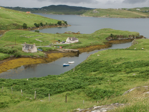
Garyvard
A small village of straw thatched huts, built partly of stone and in pretty good repair, to which there is attached a considerable portion of arable land, but the inhabitants derive their chief support from fishing, the herring fishing is their great harvest. That fish being found in great numbers at the mouth of Loch Erisort in the months of May, June and July.
So Garyvard was described in the 1850s, at the time of the first Ordnance Survey.
1830 there was a population of 38 people at Garyvard rising to a peak of 117 in 1921. The adjoining village of Caversta which included Torostay peaked at 78 in 1881 despite only having 4 crofts and another 2 in Torostay. Dr Caird’s research in 1957 indicated a “population of 78. There are 24 houses, seven of four rooms, 13 of three rooms and four of two rooms. There are 11 crofts, 33 cultivated areas, 44 acres of grass, 23 cattle and 400 sheep. There are four weavers but no other local industry.”
The people of Garyvard had more contact with Keose (across the loch) than their neighbouring villages. There was a lot of going and coming across the loch and they even used to shout to each other over the water. The main boat crossing across to Keose was from Garyvard and was used by all those going to Stornoway or to the doctor or Registrar who in those days were both located in Keose.
Various parts of the village have names of their own:
Ceann a Muigh: Crofts 7, 8, 9, 10
Baile Staigh: Crofts 1, 2, 3
Buaile: Crofts 1, 2
Tom Fraoich: Croft 4 (now Druim Froaich)
Garradh: site of council houses today, used to be a fank
Cnoc Comuinn: Lakeside and Riverside
Rubha Bhair: the peninsula between the two bays.
Booklet available.
Garyvard genealogy on Hebridean Connections.
